Geographical" redirects here. For other uses, see Geography (disambiguation).

Geography (from Greek γεωγραφία, geographia, literally "earth description"[1]) is a field of science devoted to the study of the lands, the features, the inhabitants, and the phenomena of Earth.[2] The first person to use the word "γεωγραφία" was Eratosthenes (276–194 BC).[3] Geography is an all-encompassing discipline that seeks an understanding of the Earth and its human and natural complexities—not merely where objects are, but how they have changed and come to be. It is often defined in terms of the two branches of human geography and physical geography.[4][5] The four historical traditions in geographical research are: spatial analyses of natural and the human phenomena, area studies of places and regions, studies of human-land relationships, and the Earth sciences.[6] Geography has been called "the world discipline" and "the bridge between the human and the physical sciences".
Introduction[edit]
Geography is a systematic study of earth and its features. Traditionally, geography has been associated with cartography and place names. Although many geographers are trained in toponymy and cartology, this is not their main preoccupation. Geographers study the space and the temporal database distribution of phenomena, processes, and features as well as the interaction of humans and their environment.[7] Because space and place affect a variety of topics, such as economics, health, climate, plants and animals, geography is highly interdisciplinary. The interdisciplinary nature of the geographical approach depends on an attentiveness to the relationship between physical and human phenomena and its spatial patterns.[8]
Geography as a discipline can be split broadly into two main subsidiary fields: human geography and physical geography. The former largely focuses on the built environment and how humans create, view, manage, and influence space. The latter examines the natural environment, and how organisms, climate, soil, water, and landforms produce and interact.[11]The difference between these approaches led to a third field, environmental geography, which combines the physical and the human geography, and looks at the interactions between the environment and humans.[7]
Branches[edit]
Physical geography[edit]
Main article: Physical geography
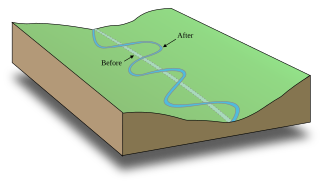
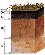
Physical geography (or physiography) focuses on geography as an Earth science. It aims to understand the physical problems and the issues of lithosphere, hydrosphere, atmosphere, pedosphere, and global flora and fauna patterns (biosphere).
- Physical geography can be divided into many broad categories, including:


Human geography[edit]
Main article: Human geography
Human geography is a branch of geography that focuses on the study of patterns and processes that shape the human society. It encompasses the human, political, cultural, social, and economic aspects.
- Human geography can be divided into many broad categories, such as:


.png)


Various approaches to the study of human geography have also arisen through time and include:
Integrated geography[edit]
Main article: Integrated geography
Integrated geography is concerned with the description of the spatial interactions between humans and the natural world. It requires an understanding of the traditional aspects of physical and human geography, as well as the ways that human societies conceptualize the environment. Integrated geography has emerged as a bridge between the human and the physical geography, as a result of the increasing specialisation of the two sub-fields. Furthermore, as human relationship with the environment has changed as a result of globalization and technological change, a new approach was needed to understand the changing and dynamic relationship. Examples of areas of research in the environmental geography include: emergency management, environmental management, sustainability, and political ecology.
Geomatics[edit]
Main article: Geomatics

Geomatics is concerned with the application of computers to the traditional spatial techniques used in cartography and topography. Geomatics emerged from the quantitative revolution in geography in the mid-1950s. Today, geomatics methods include spatial analysis, Geographic information systems (GIS), Remote sensing, and Global positioning systems (GPS). Geomatics has led to a revitalization of some geography departments, especially in Northern America where the subject had a declining status during the 1950s.
Regional geography[edit]
Main article: Regional geography
Regional geography is concerned with the description of the unique characteristics of a particular region such as it natural or human elements. The main aim is to understand, or define the uniqueness, or character of a particular region that consists of natural as well as human elements. Attention is paid also to regionalization, which covers the proper techniques of space delimitation into regions.
Related fields[edit]
- Urban planning, regional planning, and spatial planning: Use the science of geography to assist in determining how to develop (or not develop) the land to meet particular criteria, such as safety, beauty, economic opportunities, the preservation of the built or natural heritage, and so on. The planning of towns, cities, and rural areas may be seen as applied geography.
- Regional science: In the 1950s, the regional science movement led by Walter Isard arose to provide a more quantitative and analytical base to geographical questions, in contrast to the descriptive tendencies of traditional geography programs. Regional science comprises the body of knowledge in which the spatial dimension plays a fundamental role, such as regional economics, resource management, location theory, urban and regional planning, transport and communication, human geography, population distribution, landscape ecology, and environmental quality.
- Interplanetary Sciences: While the discipline of geography is normally concerned with the Earth, the term can also be informally used to describe the study of other worlds, such as the planets of the Solar System and even beyond. The study of systems larger than the Earth itself usually forms part of Astronomy or Cosmology. The study of other planets is usually called planetary science. Alternative terms such as Areology (the study of Mars) have been proposed but are not widely used.
Techniques[edit]
As spatial interrelationships are key to this synoptic science, maps are a key tool. Classical cartography has been joined by a more modern approach to geographical analysis, computer-based geographic information systems (GIS).
In their study, geographers use four interrelated approaches:
- Systematic — Groups geographical knowledge into categories that can be explored globally.
- Regional — Examines systematic relationships between categories for a specific region or location on the planet.
- Descriptive — Simply specifies the locations of features and populations.
- Analytical — Asks why we find features and populations in a specific geographic area.
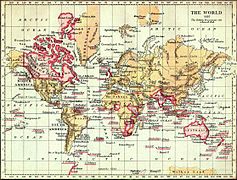
Cartography[edit]

Main article: Cartography
Cartography studies the representation of the Earth's surface with abstract symbols (map making). Although other subdisciplines of geography rely on maps for presenting their analyses, the actual making of maps is abstract enough to be regarded separately. Cartography has grown from a collection of drafting techniques into an actual science.
Cartographers must learn cognitive psychology and ergonomics to understand which symbols convey information about the Earth most effectively, and behavioural psychology to induce the readers of their maps to act on the information. They must learn geodesy and fairly advanced mathematics to understand how the shape of the Earth affects the distortion of map symbols projected onto a flat surface for viewing. It can be said, without much controversy, that cartography is the seed from which the larger field of geography grew. Most geographers will cite a childhood fascination with maps as an early sign they would end up in the field.
Geographic information systems[edit]
Main article: Geographic information system
Geographic information systems (GIS) deal with the storage of information about the Earth for automatic retrieval by a computer, in an accurate manner appropriate to the information's purpose. In addition to all of the other subdisciplines of geography, GIS specialists must understand computer science and database systems. GIS has revolutionized the field of cartography: nearly all mapmaking is now done with the assistance of some form of GIS software. GIS also refers to the science of using GIS software and GIS techniques to represent, analyse, and predict the spatial relationships. In this context, GIS stands for Geographic Information Science.
Remote sensing[edit]
Main article: Remote sensing
Remote sensing is the science of obtaining information about Earth features from measurements made at a distance. Remotely sensed data comes in many forms, such as satellite imagery, aerial photography, and data obtained from hand-held sensors. Geographers increasingly use remotely sensed data to obtain information about the Earth's land surface, ocean, and atmosphere, because it: a) supplies objective information at a variety of spatial scales (local to global), b) provides a synoptic view of the area of interest, c) allows access to distant and inaccessible sites, d) provides spectral information outside the visible portion of the electromagnetic spectrum, and e) facilitates studies of how features/areas change over time. Remotely sensed data may be analysed either independently of, or in conjunction with other digital data layers (e.g., in a Geographic Information System).
Quantitative methods[edit]
Main article: Geostatistics
Geostatistics deal with quantitative data analysis, specifically the application of statistical methodology to the exploration of geographic phenomena. Geostatistics is used extensively in a variety of fields, including hydrology, geology, petroleum exploration, weather analysis, urban planning, logistics, and epidemiology. The mathematical basis for geostatistics derives from cluster analysis, linear discriminant analysis and non-parametric statistical tests, and a variety of other subjects. Applications of geostatistics rely heavily on geographic information systems, particularly for the interpolation (estimate) of unmeasured points. Geographers are making notable contributions to the method of quantitative techniques.
Qualitative methods[edit]
Main article: Ethnography
Geographic qualitative methods, or ethnographical research techniques, are used by human geographers. In cultural geography there is a tradition of employing qualitative research techniques, also used in anthropology and sociology. Participant observation and in-depth interviews provide human geographers with qualitative data.
No comments:
Post a Comment